Geospatial Information Systems Design and Architecture - Unlocking the Potential of Your Data
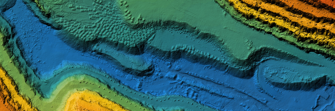
Geospatial information systems (GIS) have become increasingly important in a wide range of industries, from public services and utilities to defense and real estate. Knowing where your assets are and being able to link them to business-critical data are key to long-term planning, risk management, and maintenance operations. At picoEdge, we have the expertise to drive this information from architecture through implementation and refinement, or to step in for maintenance and staff augmentation roles.
Our team has extensive experience in GIS data management, mapping, and analysis. We understand the importance of accurate, up-to-date data, and we have the skills and knowledge to design and implement efficient GIS systems that meet your specific needs. Whether you need help with data migration, system integration, or ongoing maintenance and support, we can provide the solutions you need.
Our GIS services include:
- GIS data management and analysis
- GIS mapping and visualization
- GIS system design and architecture
- GIS system integration
- GIS data migration and conversion
- GIS staff augmentation
With our help, you can unlock the full potential of your data, streamline your operations, and make better decisions based on accurate, reliable information.
Maintenance and Staff Augmentation for GIS Systems
Geospatial information systems (GIS) are integral to many business operations, from public services and utilities to defense and real estate. Maintaining the integrity and functionality of these systems is crucial to long term planning, risk management, and maintenance operations. picoEdge has extensive experience in GIS maintenance and staff augmentation, ensuring that your GIS systems are running efficiently and effectively at all times.
Our maintenance services include regular updates, backups, and security measures to protect your data and keep your systems running smoothly. We also offer staff augmentation services, providing you with the additional resources you need to manage and maintain your GIS systems. Our team of experts can step in and provide the support you need to keep your systems running at peak performance.
Our approach to GIS maintenance is proactive, identifying and addressing potential issues before they become problems. We understand the importance of uptime for your operations and strive to minimize disruptions. Our team of experts is highly skilled and experienced in GIS systems, and we use the latest tools and techniques to keep your systems running at optimal levels.
In addition to our maintenance services, we also offer training and support for your team. We can provide training for your staff on how to effectively use and maintain your GIS systems, and we can also provide ongoing support and assistance as needed.
Trust picoEdge to keep your GIS systems running smoothly and effectively. Contact us today to learn more about our maintenance and staff augmentation services.
Data Management and Analysis for GIS Applications
The data management and analysis of GIS applications is a critical aspect of any organization utilizing geospatial information systems. At picoEdge, we understand the importance of having accurate and up-to-date data for decision making and long-term planning. Our team has extensive experience in data management for GIS applications, including data acquisition, storage, maintenance, and analysis.
Our data management solutions are tailored to meet the unique needs of each organization. We use advanced technologies such as geodatabases, spatial data infrastructures, and web GIS to ensure efficient data management. Our team is also well-versed in data standards such as ISO 19115 and 19139, ensuring compliance with industry standards.
In addition to data management, our team also specializes in data analysis for GIS applications. We use advanced analytical techniques such as spatial statistics, spatial modeling, and remote sensing to provide valuable insights for our clients. We provide detailed analysis of geospatial data to support decision making, risk management, and long-term planning.
At picoEdge, we are committed to providing comprehensive data management and analysis solutions for GIS applications. Our team of experts is dedicated to helping organizations make the most of their geospatial data, contact us today to learn more about how we can assist with your GIS data management and analysis needs.
Tailored Solutions for Your Organization
At picoEdge, we understand the critical importance of geospatial information systems (GIS) to a wide range of industries, from public services and utilities to defense and real estate. These systems allow organizations to know where their assets are and how to couple them to business-critical data, which is key to long-term planning, risk management, and maintenance operations.
Our team has the expertise to drive GIS information from architecture through implementation and refinement, or to step in for maintenance and staff augmentation roles. We work closely with our clients to understand their specific needs and goals, and to design a GIS solution that meets those needs and exceeds their expectations.
Our complete GIS implementation services include everything from data acquisition and management, to system design and deployment, to ongoing maintenance and support. We use the latest technologies and best practices to ensure that our clients' GIS systems are reliable, accurate, and scalable.
In addition to our technical expertise, we pride ourselves on our commitment to excellent customer service. We understand that GIS systems are a vital part of our clients' operations, and we work tirelessly to ensure that they are always up and running. Trust picoEdge to deliver a GIS solution that will help your organization to achieve its goals and stay competitive in today's fast-paced world.
Reach out
Learn more about how we can help your organization achieve its goals.